Pakistan unveils new political map of country; shows Junagadh, Manavdar and Sir Creek areas of Gujarat as Pakistani territory
August 04, 2020
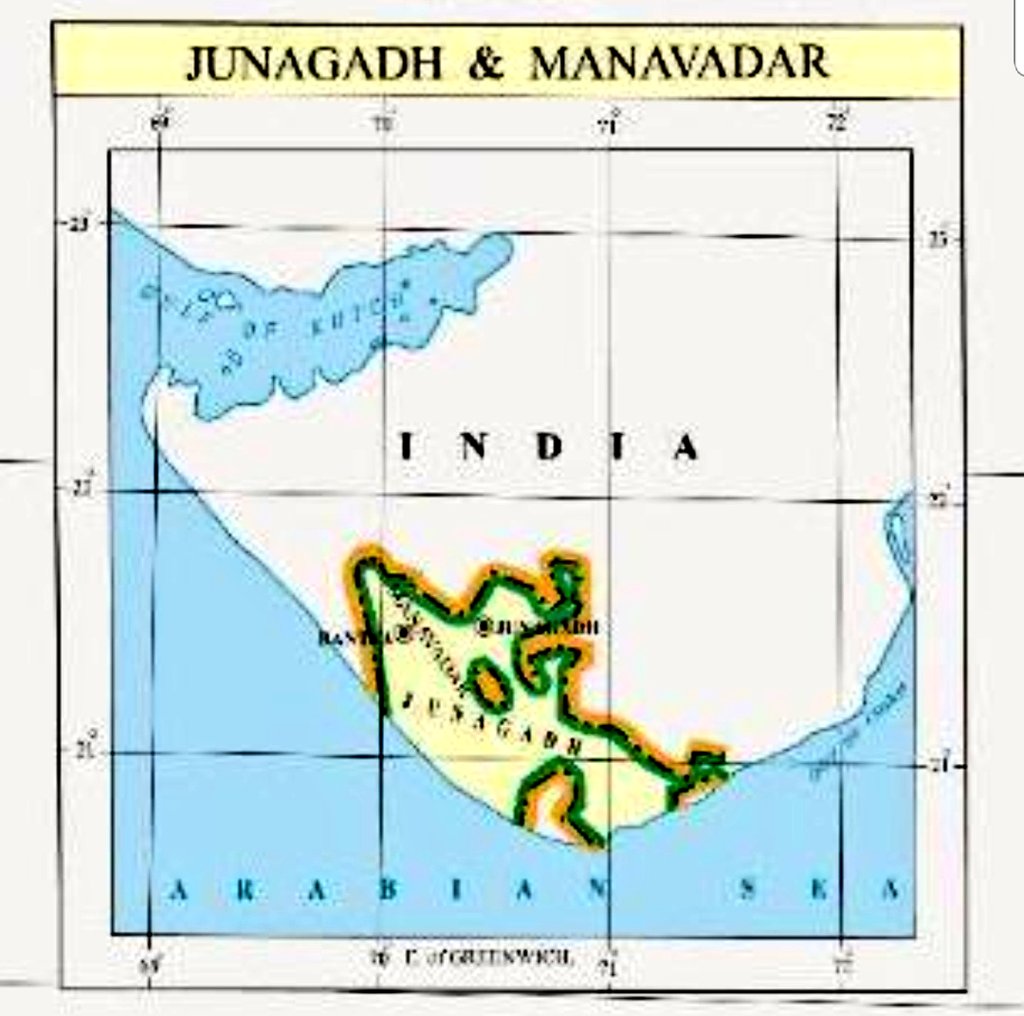
Ahmedabad: Pakistan Prime Minister Imran Khan today unveiled a new “political map of Pakistan”, integrating Jammu and Kashmir (barring the portion on China side), Junagadh, Mavadar and Sir Creek in the country’s map. Imran while launching a new “political map” said it is backed by all political parties of the country. New map will be used in schools, colleges, domestically and internationally by Pakistan, Imran Khan said. While showing Jammu & Kashmir and Ladakh in Pakistan’s map is nothing new for Pakistan as it has been done in the past too, more laughable about a map released today is that Pakistan is showing erstwhile princely state of Junagadh and Manavdar (in Gujarat, India) as Pakistani territory. Pakistan has also shown disputed coastal territory Sir Creek in its map as Pakistani territory.

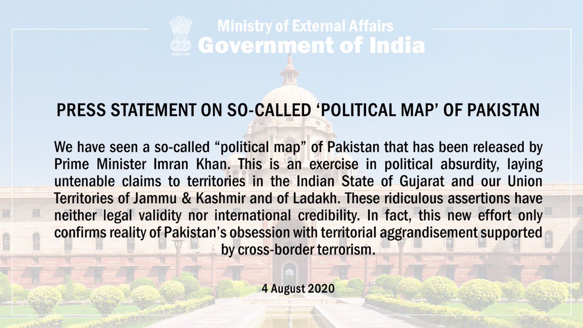
Ministry of External Affairs, Government of India’s statement on so-called ‘political map’ of Pakistan
DeshGujarat
🗃️ This story is from our archives and may contain outdated information.
Recent Stories
- Dumas Sea Face to Open for Public Today; Surat Civic Body to Launch ₹920 Crore Development Projects
- ICC men's T20 World Cup 2026 sets new global streaming record on JioHotstar during India-England semifinal
- Special flights announced to Ahmedabad for T20 World cup final
- IAS Mukesh Kumar Appointed AMC Administrator as Elected Body's Term Ends
- Gujarat Govt Appoints Administrators in Municipal Corporations